Matthew Ellis Nutter, Carlisle Artist.
www.tulliehouse.co.uk/pages.asp?type=M&url=264_Local+Artists&lvl=,48,78,264,
Click on image to enlarge.
The following cards are based on the original drawings in Nutter's book 'Carlisle in the Olden Time'.
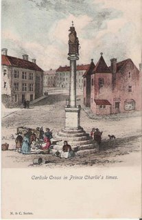
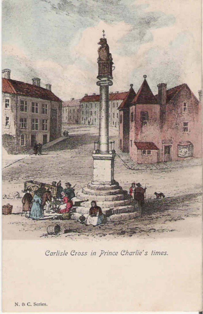
Carlisle Cross or Carel Cross, built in 1682, this was considered the centre of the city. Markets were held around it, meetings and rallies also. The hiring of farmhands and servant took place here until the early 1950s. Carlisle Great Fair is proclaimed from here.
The lion on the top may represent the Royal authority given to Carlisle to hold markets through various charters. The book it holds is the Dormont Book of the city, the rules by which the city was governed. The building on the right is the Old Guardhouse.

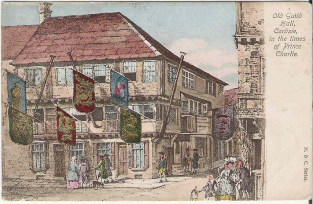
Old Guild Hall, Carlisle , in the times of Prince Charlie.
Also known as the Redness Hall after Robert de Redness for whom it was built in the early 15th.C
Taken over by the Guilds (each had a room in the building), Carlisle had the following Guilds .. Merchants .. Smiths .. Weavers .. Tailors .. Shoemakers .. Tanners .. Glovers and the Butchers. This card would show one of their special meeting days, there are still Guild members today and they cannot be forced from the building unless they fail to hold a meeting there for three consecutive years, they haven't missed yet. Well worth a look when the Council can be bothered opening it.
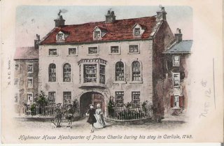
Highmoor House, the headquarters of Prince Charlie when he captured Carlisle in 1745 and of the Duke of Cumberland after he recaptured the city. It stood where Marks and Spencers is today, look for the plaques either side of the building.
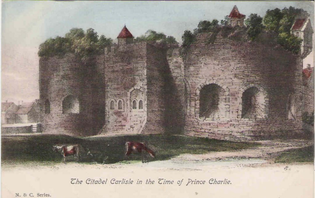
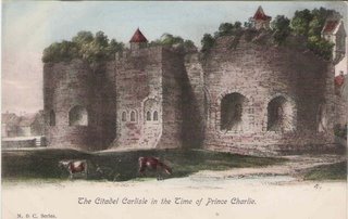 The Citadel c.1745, not quite the well kept building we see today. Built in 1541, by 1545 it was deemed a waste of time and money as the Scots tended to attack from the north. Since the English Civil war, Carlisle had been fairly peaceful and the building had been allowed to fall into disrepair, so much so that a Carlisle doctor actually had his garden on the top of one of the towers. The station side tower became the County Gaol in the early 1600s, this tower was knocked down between 1807-22 and a new tower built about 30 feet further west..
The central tower was demolished in 1804, but the lower part of the eastern tower survives and the gun ports can still be seen inside the building.
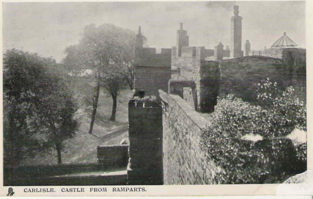
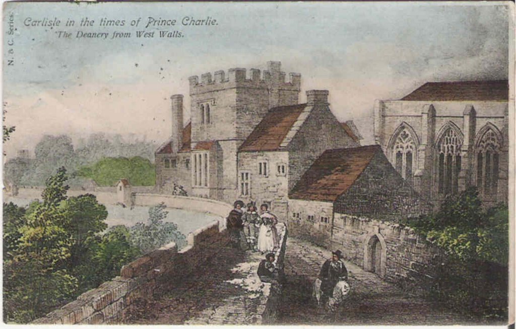
 The walkway on West Walls, as can be seen the wall was higher than it is now with watchtowers spaced at intervals. the view is almost the same today, the little doorway in the wall can still be seen.
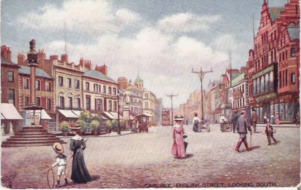
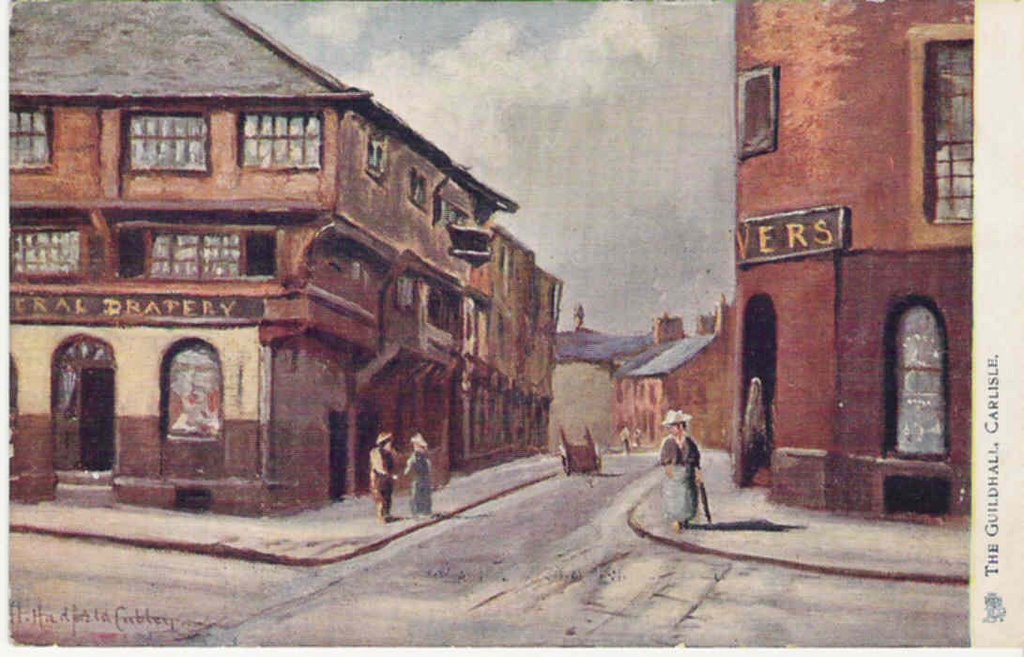
 The Irishgate, so called because the road from and to it led to the ports of Whitehaven and Maryport and thence to Ireland. The houses would have stood just about where Chivers shop is today and the cart is making its way up West Walls.
Click on image to enlarge.
The following cards are based on the original drawings in Nutter's book 'Carlisle in the Olden Time'.
Carlisle Cross or Carel Cross, built in 1682, this was considered the centre of the city. Markets were held around it, meetings and rallies also. The hiring of farmhands and servant took place here until the early 1950s. Carlisle Great Fair is proclaimed from here.
The lion on the top may represent the Royal authority given to Carlisle to hold markets through various charters. The book it holds is the Dormont Book of the city, the rules by which the city was governed. The building on the right is the Old Guardhouse.
Old Guild Hall, Carlisle , in the times of Prince Charlie.
Also known as the Redness Hall after Robert de Redness for whom it was built in the early 15th.C
Taken over by the Guilds (each had a room in the building), Carlisle had the following Guilds .. Merchants .. Smiths .. Weavers .. Tailors .. Shoemakers .. Tanners .. Glovers and the Butchers. This card would show one of their special meeting days, there are still Guild members today and they cannot be forced from the building unless they fail to hold a meeting there for three consecutive years, they haven't missed yet. Well worth a look when the Council can be bothered opening it.

Highmoor House, the headquarters of Prince Charlie when he captured Carlisle in 1745 and of the Duke of Cumberland after he recaptured the city. It stood where Marks and Spencers is today, look for the plaques either side of the building.
 The Citadel c.1745, not quite the well kept building we see today. Built in 1541, by 1545 it was deemed a waste of time and money as the Scots tended to attack from the north. Since the English Civil war, Carlisle had been fairly peaceful and the building had been allowed to fall into disrepair, so much so that a Carlisle doctor actually had his garden on the top of one of the towers. The station side tower became the County Gaol in the early 1600s, this tower was knocked down between 1807-22 and a new tower built about 30 feet further west..
The central tower was demolished in 1804, but the lower part of the eastern tower survives and the gun ports can still be seen inside the building.
 The walkway on West Walls, as can be seen the wall was higher than it is now with watchtowers spaced at intervals. the view is almost the same today, the little doorway in the wall can still be seen.
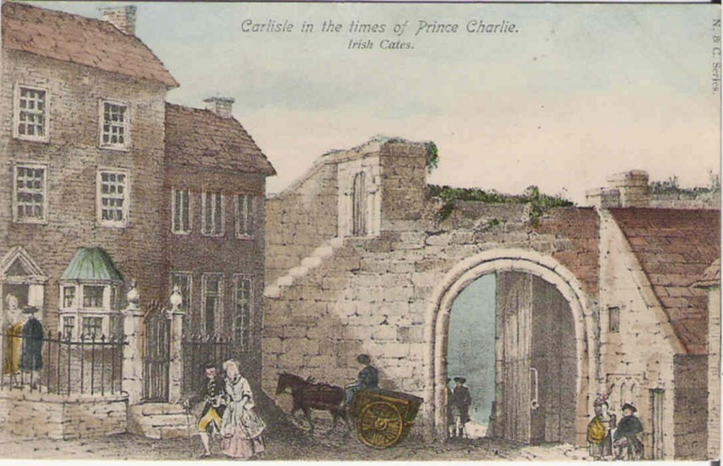 The Irishgate, so called because the road from and to it led to the ports of Whitehaven and Maryport and thence to Ireland. The houses would have stood just about where Chivers shop is today and the cart is making its way up West Walls.
posted by David at
11:16 AM
|
0 comments
![]()